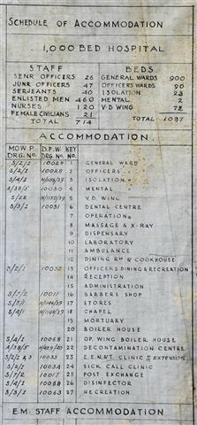
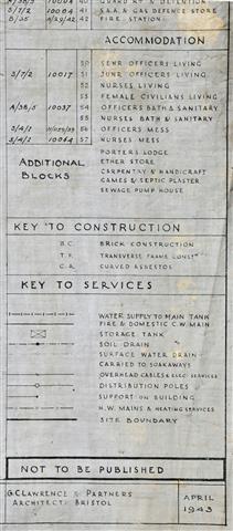
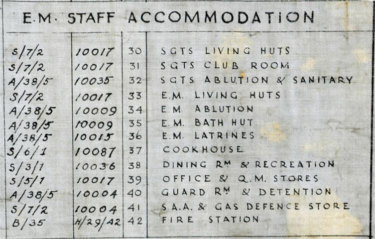
In spring 2014 a previously unknown 1943 architects map of the hospital was given to Frenchay Village Museum. The Museum gave me permission to use the information. The map indicates all the buildings and their uses in 1943. Some of the uses are not what was previously thought. For instance, the little building, labelled 4, just off the top of the left hand side of the lime tree drive, was always thought to be the gaol; it is labelled Mental on the map.
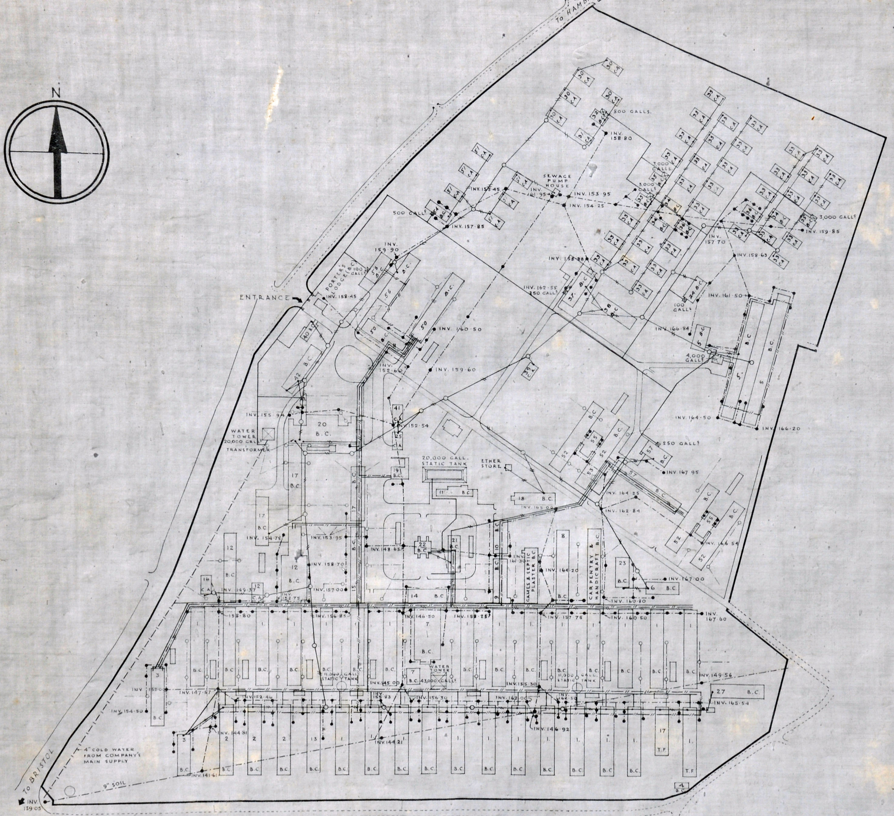
Click on the image for a high resolution version of the map.
|
|
 |
|